


Introduction
Modern marine navigation depends heavily on accurate and detailed mapping of the seafloor. One of the most significant technologies enabling this precision is the Importance of Multibeam Echo Sounders in Nautical Charting. These advanced sonar systems have transformed how hydrographic surveys are conducted, allowing for highly detailed, wide-area seabed mapping in far less time than traditional methods.
As global shipping traffic increases and offshore infrastructure expands, the role of precise nautical charts becomes even more critical for safety, environmental protection, and economic efficiency. This is where the Importance of Multibeam Echo Sounders in Nautical Charting becomes especially evident.
What Are Multibeam Echo Sounders?
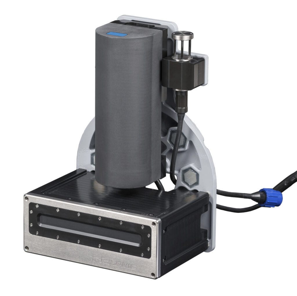
Multibeam echo sounders (MBES) are sophisticated sonar systems used on ships and survey vessels to map the seafloor. Unlike single-beam systems that measure depth at one point directly beneath a vessel, multibeam systems emit multiple sound waves across a wide swath of the seabed.
Key Working Principle
- The system sends out acoustic pulses in a fan-shaped beam.
- These pulses bounce back after hitting the seabed.
- The return time is measured to calculate depth.
- Thousands of depth points are collected per second.
This dense data collection is one of the core reasons behind the Importance of Multibeam Echo Sounders in Nautical Charting, as it enables the creation of highly detailed 3D maps of underwater terrain.
Role in Modern Nautical Charting
Nautical charting requires accurate representation of underwater features such as channels, reefs, wrecks, and seamounts. Multibeam echo sounders provide a complete picture of these features in a single survey pass.
Improved Accuracy and Coverage
Traditional surveying methods often leave gaps between measured points. In contrast, MBES systems provide continuous coverage of the seabed, reducing uncertainties in depth measurement.
This improved precision highlights the Importance of Multibeam Echo Sounders in Nautical Charting, particularly for identifying hazards that could endanger navigation.
Real-Time Data Visualization
Modern systems can display seabed maps in real time, allowing surveyors to make immediate decisions during data collection. This capability improves efficiency and reduces the need for repeat surveys.
Applications in Hydrography and Marine Industries
The use of multibeam echo sounders extends beyond navigation safety. They are widely used in multiple marine-related fields.
1. Safe Navigation Routes
Shipping lanes and harbor entrances must be regularly surveyed to ensure safe passage. MBES helps detect underwater obstacles that could damage vessels.
2. Offshore Construction
Oil rigs, wind farms, and subsea pipelines require detailed seabed analysis before installation. The Importance of Multibeam Echo Sounders in Nautical Charting is evident in site planning and risk assessment for such projects.
3. Environmental Monitoring
Researchers use seabed mapping data to study marine habitats, sediment movement, and ecological changes over time.
Advantages Over Traditional Echo Sounding
Multibeam systems offer several advantages compared to single-beam echo sounders:
Wide Swath Coverage
A single pass covers a large area, reducing survey time significantly.
High-Resolution Mapping
Produces detailed 3D models of underwater terrain, improving interpretation of seabed structures.
Increased Efficiency
Less time at sea means lower operational costs and faster project completion.
These advantages reinforce the Importance of Multibeam Echo Sounders in Nautical Charting in both commercial and scientific applications.
Challenges and Limitations
Despite their advantages, multibeam echo sounders also come with challenges.
High Equipment Cost
The technology and installation costs can be significant, making it less accessible for smaller organizations.
Data Processing Requirements
Large volumes of data require powerful software and skilled analysts to interpret results accurately.
Environmental Factors
Water conditions such as salinity, temperature, and seabed composition can affect sonar performance.
Even with these limitations, the Importance of Multibeam Echo Sounders in Nautical Charting continues to grow as technology advances.
Future of Multibeam Technology in Nautical Charting
The future of hydrographic surveying is closely tied to advancements in multibeam technology. Integration with artificial intelligence, autonomous survey vessels, and cloud-based mapping systems is expected to further enhance efficiency and accuracy.
As these innovations develop, the Importance of Multibeam Echo Sounders in Nautical Charting will become even more pronounced, supporting safer navigation and better ocean understanding.
Conclusion
Multibeam echo sounders have revolutionized the field of hydrography by providing high-resolution, wide-area seabed mapping capabilities. Their role in ensuring safe navigation, supporting offshore development, and enabling environmental research cannot be overstated.
Ultimately, the Importance of Multibeam Echo Sounder in Nautical Charting lies in their ability to deliver precise, reliable, and comprehensive underwater data that modern maritime operations depend on.
